Monday, 2 November 2020

MISS ELAINEOUS VISITS ST MICHAEL'S MOUNT...

 Maybe I should call this a "see" rather than a "visit."  Entry onto the island is only allowed with castle tickets, which I'd booked.  But the powers that be decided to close the island for the day, as strong winds would have made visiting the castle unsafe.  
They weren't kidding!  We chose to walk the 2.7 mile coastal path to Marazion seafront, then took the causeway over to the island, making it a 3.3 mile walk in total, and the wind was certainly whipping up a wild dance!  My hair ended up blowing across and sticking to my phizog, with the aid of salty, drying tears.

Here is our view from the Penzance end of the path.
St Michaels's Mount may have been the site of a monastery from the 8th to the early 11th centuries.  It's been mentioned that Edward the Confessor (r.1042-1066), one of the last Anglo-Saxon kings of England, gifted the site to the Benedictine religious order of Mont Saint-Michel. 

Conversely, it's also been reported that William the Conqueror (r.1066-1087) gifted the monastery of Mont Saint-Michel (its larger historic physical counterpart in Normandy, France) the Cornish island as a reward for their support in his claiming of the throne of England.  St Michael's Mount then became a priory, modelled after its French equivalent.  They share the same tidal characteristics and shape, although, at 57 acres, the English version is much smaller than its 247 acre brother.
I rather like the idea of this as my surname means "from La Rochelle-Normande," which (as the name suggests) is in Normandy.  Here is a PDF of Mont Saint-Michel...

The castle dates to the 12th century, and a side effect of the dissolution of enemy religious houses (those under the control of a mother-house outside England) meant that from 1424 its association with Mont Saint-Michel ended.
In 1659 the mount was sold to the Colonel John St Aubyn, and in 1954 his descendent Francis Cecil St Aubyn, 3rd Baron St Levan, gave most of the mount to the National Trust, retaining a 999 year lease to inhabit the castle and manage the public viewing of its rooms.

The causeway is only accessible for a few hours each day, and even then not all year round.  During the winter months the island's residents have to take the boat to the mainland.  It is one of 43 tidal islands which are unbridged, and can be walked to from mainland Britain.  Around 30 people now live on the island, and everyone plays their part in making sure the island runs smoothly.

This part of the causeway is actually an artery leading off to a section of rocks with built-in stairs, which act as a good viewing point.  The paving stones are very rustic, and I will make an effort to buy proper walking shoes for my adventures (although my wedge sandals were grippy enough to do the job...)😀  

The view from the aforementioned rocks, and the island does look rather foreboding, photographed in silhouette.
The causeway was raised one foot (30cm) higher in 1879, using sand and stones from the surrounding area.  Repairs were completed in 2016, after storm damage in 2014.  It's been indicated that a rise in ocean waters (along with natural erosion) could put St Michael's Mount at risk.

Peering over the barred wooden gate at the end, which was well and truly closed.  I wasn't unduly upset- there was nothing I could do about the trustees' decision, and the castle and gardens and their surrounding delights will still be here the next time I come and visit.

The white building to right is the island shop.  
It is thought that over 2000 years ago St Michaels Mount was a trading centre for the tin industry, with Phoenician ships exporting Cornish tin to the rest of Europe. 

The harbour, and there is a short underground narrow gauge railway (a small stretch of which is apparently visible from the harbour) which is still in use to bring goods up to the island and take away rubbish.  It's not open to the public. 

Little is known of the village on the island before the 18th century, although apparently there were a few fishermen's and monastic cottages.  It was only after harbour improvements in 1727 that St Michael's Mount began to flourish as a seaport.   The population of the island was thriving in the early 1800s, with over 300 residents living down four streets, in 53 houses.

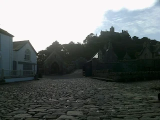
The view back down the causeway, and the cobbles are much more bobbly (and wobbly!) at this end.  The SuperDean, leaning against the wall, was starting to get a bit bored and annoyed by this point.  I also overheard a father lecturing his teenage son, who was similarly moaning!

An almost identical photograph to that taken earlier in the day, as we left the island and did the whole walk in reverse (no, we didn't walk backwards!😁)
The castle has featured in several films, including the 1979 film Dracula, where it represented the exterior of Castle Dracula; the James Bond film Never Say Never Again; and also in Johnny English, where it was used as the exterior for character Pascal Sauvage's chateau.

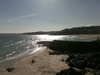
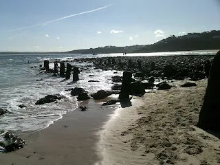
Overlooking the blustery beach, whilst trying to avoid sand in the eyes, and Land's End is somewhere behind the headland to the centre of the photo...

When I get the chance, I will return to do a full investigation of the island, castle and gardens.

* * * * *

Well, two years later I returned- only to have my castle visit cancelled due to bad weather (to be fair, the day turned out to be appalling).  But this time we were allowed to wander around the island.  
We took a rather wet walk around the harbour...

This witch's hut is where tickets up to the castle are checked...

The steps up to the castle do look rather rustic...

The Island Shop is within this section of buildings, as is the Visitor Centre...

Macabre little moi just had to look through to the graveyard, although the church is contained within the castle...

Since 1892 St Michael's Mount has been part of Marazion parish...

The church of St Michael & All Angels was largely rebuilt in the 14th century, although the footprint of the church dates back to 1135.

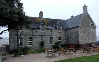
The Island Café is within these walls...

Standing by the café and looking past the graveyard walls over to the gardens...

The gardens are hidden behind the trees and are accessible on some days.  Apparently you can get a clear view of them from the castle, meaning it's might not be necessary to pay the separate admission fee...

Looking back to a blurry Marazion, and the fine, spitting rain was really giving it some at this stage...

Looking across the outside dining area and over the causeway...

* * * * * 

2023 update- I finally made it inside the castle! But I was filming, and my work was unusable as stupid me got my exposure wrong (ooh err missus!)😁
But here are a few phone photos.

Looking over the harbour as we arrived. This time we had to take the boat both ways as the causeway was inaccessible.

The view from over the castle walls.  Peer, and you can make out the drowned causeway...

Legend had it that here lies the stone heart of Cormoran; Cornwall's most feared giant.  He was lured into a hole, and all that remained was his petrified heart.
  
You can see it clearly here, standing just beyond the sign and turning back- it's not to be confused with the larger, similarly-shaped stone you can see in the previous photo!

* * * * * 

I loved this St Michael's Mount model, located inside the Visitor Centre...

By the time we crossed the causeway the rain had turned heavy, so we took the bus back into Penzance.  Here's a lone seagull looking at us like we were daft...

I'm sure one day I'll come back and the castle will be open and I'll get some decent photos (*sighs!*)
Until then...

TTFN

The Miss Elaineous

XXXXX
XXX
X


Sunday, 1 November 2020

MISS ELAINEOUS VISITS ST IVES (AGAIN...!)

 This was my second trip to this picturesque seaside town, which sits in St Ives Bay, Cornwall.
Once a thriving fishing community, it is now very tourism orientated (every other establishment appeared to be a Cornish pasty bakery!) with a strong emphasis on art.
The name St Ives derives from the legend of the arrival of the Irish saint Ia of Cornwall in the 5th century AD.

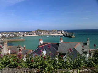
On alighting from the turning circle which is the bus station, I took this photograph of Porthminster Beach.  Despite being October, the sky was still a beautiful shade of blue.  The long arm to the centre of the photo is Smeaton's Pier...

This photo was taken during our previous visit, in May 2019.  I've included it as it shows the West Pier, to the left of the photo.  There was also a third, wooden pier which was constructed in 1864 but collapsed.  More about that later...

This is the view north, taken from the same spot.  The thin white needle on top of the mound to the centre of the photo is Godrevy Lighthouse, which was constructed in 1858-1859, and stands 300 metres (980 ft) out to sea.  Built to mark the hazardous Stones Reef, landing keepers onto the island was always a perilous practice.  Originally manned by two men at a time, working two months on and one month off, it's been automated since 1933.

The lighthouse is 26 metres (86 ft) high and is octagonal.  We had booked to take a boat trip around the island but it was cancelled, apparently due to weather conditions.  Well, the weather and sea looked fine to me, but I suppose they know best.  I've walked up the beach from nearby Hayle; from Riviere Towans to Gwithian Towans, as close as I could get to the lighthouse, and the sea does look very choppy when it rebounds off the corner of the bay.

St Ives is full of cuteness, such as this little shopping courtyard...

This was taken standing in front of St Ives Museum, looking down onto Bamaluz Beach...

The third, skeletal pier was not revealed the last time we were here, as the tide was high.  But this time we clambered down the stone stairs, over the rocks and onto the beach...

Made of wood, the pier didn't stand the test of time and gave up the ghost and collapsed in 1864...

I have to say, although the beach is pretty, I wouldn't want to swim or paddle in the water.  These underwater obstacles would be treacherous...

By this time the tide was already cutting off the beach, so we took the stone walk upwards onto Smeaton's Pier.

St Ives Museum, which was well and truly closed, up on the headland.  The last time we were here we visited the Barbara Hepworth Museum and Sculpture Garden.  Read all about that day here:-

John Smeaton (1724-1792) was a prominent civil engineer, and the pier was constructed between 1769-1770, from his design.  The original 120 metre (360 ft) pier was almost doubled in length in the early 1890s.  This lighthouse, which is now halfway down the pier, was once at the end... 

Here is a blown-up photo taken the last time I was here, which shows both lighthouses- the one at the end dating from the 1890s.  I assume that they work after dark- St Ives is still, after all, a working pier, and you can definitely see two prominent lights emanating from this area from Hayle, where we were staying.

Leaving the beach and harbour and looking back the way we'd walked, you can see Godrevy Lighthouse far off in the distance.  It was the inspiration for Virginia Woolf's 1927 novel To The Lighthouse.  She holidayed here as a child- however, she placed her fictional lighthouse in the Hebrides.  Although I like the autobiographical elements to her work, this was written in her "stream of consciousness" style, which I find rather trying and skittish. 

This is Lambeth Walk Beach, which was on our walk back (and up!) towards the bus station.

The bronze sculpture is listed across the internet as Epidauros II (1961) by Barbara Hepworth...  But it's written as Epidaurous underneath the actual piece.  A simple thing, but someone pedantic like me would notice it!  Hmm, the mind boggles...

Bird's eye view back to Hayle, where we were staying.  Talking of birds, a family next to where we were sitting waiting for our bus chose to crumble some cake crumbs near us.  The seagulls swooped- and dropped a dirty present on the SuperDean's leg!😆
We decided to play the lottery as it's deemed lucky- but didn't win...😒

St Ives, I will return, if only to scoff a pasty and go on a Godrevy Island boat tour.

Until then...

TTFN

The Miss Elaineous

XXXXXXXXXXXXXXXX
XXX
X


Wednesday, 7 October 2020

MISS ELAINEOUS VISITS SOUTHEND CLIFF GARDENS...

It would be perhaps wrong to describe this as a "visit," when really it was only a "walk through..."
I've been to Southend-on-Sea many times, as it's easily accessible from London as a day trip.  We often walk down a mile or so to the seafront at Westcliff-on-Sea, which has a plethora of fish and chip restaurants, which I affectionately refer to as "grease dens."  Rather than take the rather prosaic road beside these, it's much more interesting to walk between the Victorian villas at the top of the cliffs, and through the pretty gardens.

I've also created a YouTube vlog, link here:-

Here you can see the l-o-n-g arm that is Southend Pier.  I do like the little Ferris wheel flowerpot feature at this entrance to the gardens.💜

The theme park is called Adventure Island, and was very much closed on the day we went.

Southend Cliff Railway, or Southend Cliff Lift, was constructed and opened in 1912...

It can hold 12 passengers, although climbing these stairs is great if you want to keep fit...

Possibly my favourite photograph of the day, featuring the calm sea, the pier and the angle downwards.
Piece of useless information- there was once a very impressive Only Fools and Horses exhibition held at the end of the pier in their Royal Pavilion (a rather nasty looking modern building, developed in 2000, which also houses their café- they used to have a rustic-looking bar at the end, and I much preferred that!)

They moved the exhibition to the pier head, and this photo of Dean by Del Boy's van was taken three years ago...

You don't see many old red telephone boxes in the UK, so when you do, they just have to be photographed!😊

Queen Victoria to the left...

This was presented to the town by Mayor Bernard Wiltshire Tolhurst, to mark the 1897 Diamond Jubilee.

The clock at the entrance to Prittlewell Square was donated by local philanthropist and jeweller Robert Arthur Jones, and was repaired and restored to its original glory in 2019.

The beautiful pond and gentle fountain.  This park is deemed the oldest in Southend, but I'm damned if I can find any information regarding its opening date!  I do, however, know that Southend sprung out of what was the south end of Prittlewell in the 1790s.
 

Could I live in the big houses to the left?  I had to give it some thought, as they seem to get a lot of shade but yes, I probably could...

Cloud formations over a peaceful sea...

Looking back towards the pier...

A bucolic exit...

The Southend War Memorial was designed by architect Sir Edwin Lutyens...

This cenotaph was unveiled in 1921...

The bright sunlight is making this section look almost tropical!

These curved hedges give a kind of amphitheatre feel to the gardens as they descend onto the road...

The gardens have their own pavilion/ seating area...

It looked quite elegant, and the obligatory winos who frequent such places appeared to be absent on this day...

Picturesque descent...

On the pavement, and looking upwards to the Westcliff Hotel, the white building juxtaposing the sky...

Cliffs Pavilion theatre is the Art Deco building up high, and the aforementioned Westcliff "grease dens" are to the left of the photo, barely discernible at ground level.

A few years back we actually alighted from the train at Westcliff and ate first before venturing down to Southend.  This included a little wander into the charity shops, and here's a beautiful pair of mules I found for something like £4.50...

We found the restaurants surprisingly crowded for a Wednesday so, disappointed, turned and walked back to Southend.  After calamari 'n' chips, we took ourselves off down the pier.
Southend Pier is the longest pleasure pier in the world, at 1.33 miles (2.14km) long, and its first stone was laid in 1829, on 25th July (my birthday. )  An iron pier, replacing the original timber pier was opened to the public in 1889.  In that time it has suffered its fair share of tragedy, including several fires and a boat crashing into it.  Really?  It's hardly as if the pier is easy to miss!

Southend's status as a seaside resort grew after Princess Caroline of Brunswick (the estranged wife of the Prince Regent- later George IV) visited in the 19th century, followed by the coming of the railways.  The town declined as a holiday destination during the 1960s.
 This panorama was taken by the SuperDean- do you prefer his photo or mine?

We walked all the way down the pair, and sat and relaxed down the end.  It wasn't overcrowded with people and was quite a pleasant respite.  Here's a boat navigating its lonely way along the Thames Estuary.

We often take the pier train back, but chose to walk instead.  After a few months in lockdown, spent glued to my computer completing my MA, I needed the exercise!

I will return to Southend as it's so easy for me to reach by train.  Until then...

TTFN

The Miss Elaineous

XXXXXXXXXX
XXX
X