Saturday, 3 December 2022

THE HAUNTING OF THORES-CROSS by KAREN PERKINS

 THE HAUNTING OF THORES-CROSS

BY

KAREN PERKINS


THE BLURB:-

A haunting historical thriller set in Britain's North Yorkshire Moors about isolation, superstition and persecution, The Haunting of Thores-Cross explores 18th century life in a picturesque but isolated village in the North Yorkshire Moors.


When a vulnerable young girl is ostracised within her community and accused of witchcraft, the descendents of her neighbours will suffer for centuries to come.


THE REALITY:-

Was it really necessary to spell out the North Yorkshire Moors twice in the blurb? I think not, and its an oversight by the publishers (yes, I know I'm being petty!) This is a setting I have some affinity with, having loved the tales penned by the Bronte sisters, and also some of the work by Yorkshire blockbuster writer gal Barbara Taylor Bradford. It's also were I went this year, for my graduation from my (distance learning) MA and also where I will go to next year, for a break in Filey. The landscape and scenery of this area were beautifully documented, as were the regional accents used by (it seems) all of the characters in this novel. I loved the idea of a hidden village, sitting beneath the man-made flooded dam.


This definitely had something going for it as I finished it in only a few days, but I felt more for the historical settings and the character of Jennet than I did for modern-day Emma. I can certainly understand Jennet's wrath at those who'd hurt her, following the awful bad luck she had of (spoiler alert!) losing both parents at once and then her twins. I loved her vindictive nature- she wasn't about to take certain things lying down, and can certainly respect her glee when it seemed that some of her curses appeared to be working. Go, gal! Unfortunately, given the grim superstitions of the time it meant she was accused of being a witch, and that spelled her downfall.


I did like Emma, but with her parts of the story seemed to get far fetched. Did she really believe she was carrying Jennet's child and not her own, and that Mark, the father of the baby (and not her husband- rather, the husband of her friend who lived in Jennet's old cottage) was actually Richard Ramsgill? Having recurring dreams dictating the past is one thing, but actually carrying around this belief sounded plain daft. I also can't believe that Kathy and Dave readily accepted their spouses' affairs so easily. This author has been likened to Barbara Erskine, and that's another author whose stories start interestingly and with enough realism to carry them, but end up turning into something away with the fairies. I'm not sure that approach is my kind of reading, but I'd be prepared to give both Perkins and Erskine another go.


Monday, 14 November 2022

MISS ELAINEOUS VISITS BRYHER...

Bryher was my final Isles of Scilly off-island visit and I travelled solo once again, as the SuperDean didn't want to come out and play.  It's one of the smaller inhabited islands; being 1.2 mi (2km) long by 0.62 mi (1km) wide, and only 84 people reside here.

I've also created a YouTube vlog about the island, link:-

Bryher sits right next to Tresco and this photo taken from the boat as I approached shows the southern end, with Tresco Abbey visible to the centre of the photo. 

New Grimsby Harbour is to the left of the beach in the centre of the photo, and it's where we'd alighted when we'd visited Tresco.  The two islands are so close that two-island day trips are often available and sandflats can be exposed during low tides.

To me, Bryher was the island that seemed the most about farming- possibly due to the presence of Veronica Farm, which offers holiday lets, and makes extraordinary fudge.
As this group of gals was right near the farm, I think we can safely assume that their contribution is an essential part of that business! 😀

I took a path that seemed quite low down, and which ran parallel to the sea, and popped into the farm.

They sell their fudge, amongst other things, in this little shed.  It's a big version of an honesty box!

I chose the rum raison and it was very good.  It had quite an unusual texture as it's crumbly, and melt-in-the-mouth.  I prefer this to chewy fudge which puts your fillings at risk! 

I trudged down the main central roads.  The residents tend to live around quite a narrow zone between the shores and hills, and to the south of the island, as the north and the outer edges are too exposed to the temperamental elements to be cultivated.

All Saints' Church is the most westerly Anglican church in England, and dates back to 1742.
The quay I'd alighted from is called Church Quay (one of two quays on the island) and is so called because of its proximity to the church.

All four stained glass windows were replaced by local Oriel Hicks in recent times, with the work being completed in 2007.  They represent sayings of Jesus Christ, and this one is supposed to be lilies in a field.

The church is open every day, although services only take place on Sundays throughout the summer season, and on special occasions.

The church has been a listed building since 1975.  Of course, macabre little me just had to take a graveyard photo! 

Looking towards the water, with Anneka's Quay to the right.  This quay is also known as Bar Quay, and dates from 1990, when it was built- by volunteers- for the television programme Challenge Anneka...

Hangman Island (I've also seen it written down as Hangman's Island), Cromwell's Castle and King Charles's Castle (with the latter, I don't think they're referring to the current chap...😁)

It was easy to view Cromwell's Castle- which sits on Tresco- from Bryher's east coast.  Built by naval officer Sir Robert Blake between 1651-52, right at the end of the English Civil War (1642-1651), it was named after Oliver Cromwell; leader of the Parliamentarians.

Island Fish, with it's picturesque outdoor seating area.  There is also a crab shack on the island, but it was all boarded up for the winter.

Looking down from the main track, and apparently, sea levels would only need to rise a few metres for the southern part of the island to turn into its own archipelago of five or six islands.

When I heard there was a phone box museum on Bryher, I assumed it was a museum containing phone boxes, and not a museum within a phone box- silly me!

It's a pop-up museum which was set up in 2018 to commemorate the 30th anniversary of the film When the Whales Came, and features memorabilia regarding that film...

The film was based on Michael Morpurgo's book, which was set on the island.  The film starred Helen Mirren and was shot here in 1988...

The flatness of these trees kind of gave them a Japanese feel...

Olivia's Kitchen Café & Restaurant serves a great selection of food and drink, including some stunning cakes- I just wasn't peckish enough to try them!

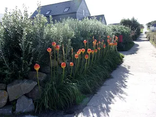
Bryher Shop is the building behind these beautiful Kniphofia Red Hot Popsicles (I also saw some of these striking flowers on St Agnes).

Bryher Gallery sells ceramics, textiles, cute little decorative thingumajigs such as these below and, of course, paintings.

Overlooking the Great Pool- an inland lake south of Hell Bay Hotel...

...I have to say, the area didn't look much like hell to me!

Boats on the water between this island and Tresco...

Crops being protected by cloches...

It was a peaceful walk around the island, but these volcanic rock formations just jutting out of the water fascinated me...  

I wouldn't mind if that was my view- but just for a holiday as I think this place is too remote for even antisocial little moi to reside in!

Twisty palm tree where the road looped round...

Looking towards a moody sky, with the sun throwing the landscape into silhouette...

I believe The Lookout is simply someone's house- I just loved the floral displays surrounding it...

Peering down onto the water.  The day was very warm for October...

Chickens clucking away and minding their own business.  I think this island reminded me of farming the most as I seemed to encounter more tractors here than anywhere else.

More Kniphofia Red Hot Popsicles lurking by the road...

These flowers seem to be a special feature of this island!
This rock is not actually called Fraggle Rock...

...It sits behind this bar and I loved the name of it- Fraggle Rock...😁

But the rock it overlooks is actually called Hangman's Rock.  There is a jib and noose on top of Hangman's Rock, although that is a modern day addition.  It is thought that mutinous sailors were once hanged here.

Behind the rock you can clearly see Cromwell's Castle, and high on the hill is the ruin of King Charles's Castle, a ruined artillery fort which was built between 1548-51.  Both buildings are managed by English Heritage, and it was King Charles I who gave the latter castle its name.

A quick visit to the little girls' room revealed this strangely phallic blue soap- I'd never seen anything like it before, and rudely commented that it must be what a Smurf's penis looks like!!!!
😁😁😁😁

Bryher has been named a rat-free zone- if you spot one of these rodent invaders you have to report it, as they can pose a threat to migratory birds...

My pre-leaving view, taken from the beach whilst waiting for the boat from Anneka's Quay, with Hangman Island to the left...

It's hard to believe that you can actually walk across from Bryher to Tresco during low spring tides!  You can also walk to uninhabited Samson, below, and here's my view from the boat back.

Bryher, I will be back next year- my holiday is all booked!

Until then...

TTFN

The Miss Elaineous

XXXXX
XXX
X

Sunday, 30 October 2022

MISS ELAINEOUS VISITS ST AGNES...

 St Agnes was the island I was looking forward to visiting the most, as it's a place I perceived as the most desolate and remote of the inhabited Isles of Scilly islands, and it's the most southern part of the United Kingdom.
Yes, I wasn't wrong, but that doesn't mean that St Agnes is without any kind of civilisation.

I have also created a YouTube vlog about the island, link:-

I arrived on Porth Conger Quay, and this island has just the one quay, so I didn't have to make sure I knew where I was getting picked up (I am an organised creature and do like to pre-plan, negating the need for last minute panicking or rushing...)

The Turks Head is the only pub on the island, and is literally a minute's walk from the quay.  St Agnes is commonly known as just "Agnes" to the locals, although it is sometimes affectionately referred to as "Aggy."

The Turks Head was opened in 1972, although a previous incarnation on the site dates back to 1939.
On this day I was flying solo, as the SuperDean didn't wanna come out and play...

I especially wanted to cross over to Gugh, which is reached by a tombolo; a kind of sandbar- a natural isthmus created by tidal deposits.

The tide was on its way out, having been high enough to cut Gugh off from St Agnes between 1-1½ hours earlier (depending on which tidal guide you were referring to...)

Standing on the sand, and at least I'd bothered to use my common sense and check the tide times- a group in front of me evidently hadn't, so I had to educate them as they seemed concerned that the tide was rising...

85 people live on St Agnes, which includes only 3 on Gugh.  St Agnes is one of the smaller islands, and only about a mile wide.  It's actually smaller than Bryher, but larger when you add Gugh to its mass. 

The central stone of this stack has the name Gugh very prettily painted on it.

Looking back to St Agnes, and Gugh is only 0.62 mi (1 km) long by 0.31 mi (0.5km) wide.

Both houses were built in the 1920s by Charles Hamlet Cooper, an industrial engineer.  They have Scandinavian style roofs, which apparently make them more likely to withstand any wild and exposed weather...

Looking north from the rough grass of Gugh...

This heap of rocks conceals a burial cairn, and this one is known as Carn Bite.  Cairns (taken from the Gaelic "carn" meaning a human-made stack of stones raised for a purpose) sometimes have a burial cist at their centre.  A burial cist is an ossuary; a small stone coffin used to hold the bodies of the dead.

Beautiful sunlit view south from the tombolo...

Back on St Agnes, and here's Covean Cottage Guesthouse and Café- they also operate as a takeaway pizzeria on some nights.

Palm trees, some lucky person's roof, and a beautiful blue sky.  We only had one grotty day on the Isles of Scilly weatherwise, and this wasn't it!

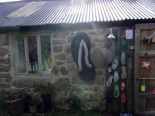
I loved the decorative flip-flops outside one of the routes into Pot Buoys Gallery...

They sell art in the form of paintings, sculpture and jewellery...

Beautiful flora and fauna abound here, and these tropical red hot pokers are called Kniphofia Red Hot Popsicles.
😀

Cows having a lie down, and these must be part of Troy Town Farm, whose ice cream is sold all over the island.  Everything is farmed on site- the cows graze here, are milked here and the resulting cream is used to make the ice creams.

A traditional phonebox and the first glimpse I got of St Agnes Lighthouse.
It might seem a strange place to have a lighthouse, as it's inland, but perhaps it's the island's highest point- it certainly looks it.  It stands 22.5m (74 ft) above ground and 42m (138ft) above mean high water.

Built in 1680, the lighthouse is the oldest of the six Scilly lighthouses, and is no longer operational.  It has the unusual feature of gun ports in the structure of the tower and the lantern part of the equation was fired firstly by coal and then by oil. 

In 1880 the optical equipment was upgraded and consisted of fourteen reflective lamps arranged in two tiers, and the speed of rotation was doubled.  But the lighthouse was always prone to fog- perhaps due to its inland location- and was decommissioned in 1911.

A stone snowman, stone reindeer, and what looks like a snow-woman add an interesting touch to this field!
 
The lighthouse now serves as a daymark for shipping and is privately owned living accommodation...

This is a farm I passed (name unknown).  I just thought it looked colourful, and a fun place in which to hold a mini-festival!
You can rent apartments on some of the farms, and St Agnes is the only inhabited island without a hotel.
 

The side of that farm had attractive and geometric hand-drawn patterns on the window.  I just thought it looked cheerful...
💜💛💚💙

Bishop Rock Lighthouse is visible over the water.  It was completed in 1858 and is 49m (161ft) high.  It is an impressive structure and is often referred to as "King of the lighthouses."

Troy Town Farm is the southernmost settlement on the United Kingdom.
This moggy is probably more interested in the cream used to make the ice creams, though...😁

If he's the farm pussycat, then he's the luckiest cat in the world!
😻

Taking a few minutes to enjoy the view, overlooking the campsite...

Plenty of little fauna friends came to join me at my table.  I've since learnt that these abundant birds are called turnstones.

I walked around but the track was waterlogged, so I decided to walk back the way I'd come.
 Annet can be viewed from here, is an uninhabited island and is known for housing several species of bird; including puffins and storm petrels...

There is Troy Town Maze- a small labyrinth reputed to be dating from 1729- in this area, but I elected not to travel "off piste" in the sandals I was wearing.
The strange inland formation on this photo includes a stone which resembles a chipped tooth...

This photo is a 2023 update, when we did seek out the maze- and found it a tad underwhelming!
It's reputed to have been laid down by either a lighthouse keeper or his son, but a much older maze was revealed in the 1980s, following excavations on the site. 

 On the walk back the lighthouse and Christmas crew had been joined by a (real) two-tone monochrome horse.
💗

The isthmus had widened so I took another trek over to Gugh...

Stone stacking is actually quite difficult- you have to get the balance just right!

Looking over the water to the quay.
There is a Bronze Age (3,5000 years ago) sloping standing stone called The Old Man of Gugh further around this island, but my sandals- although thick soled- were good for slipping off and paddling in but possibly less good for rocky paths...

...So I decided to get my feet wet instead!  Don't be fooled by the prettiness of the water- the currents can be vicious and I managed to step right into quicksand next to it, so I advise proceeding with caution.

The next three photos are also an addition to this blog, following my visit to the Isles of Scilly in 2023- this time I was wearing more suitable footwear!
The tide was at its lowest, and the tombolo was really wide.

We hiked further across the centre of Gugh as we were looking for The Old Man of Gugh- a Bronze Age menhir which dates from C15th-C5th BC.  The day was windy and overcast, but you could still make out St Mary's over the water.

Side view, and this leaning menhir is 2.7m (9ft) tall and is the UK's most southerly standing stone.  This area is littered with cairns and entrance graves from around the same era.  The latter show evidence of both cremation-
 with the remains placed in pottery urns- and natural interment.  Any valuables placed with the dead have long been stolen.

The Turks Head is the most south westerly pub in the British Isles, and I stopped to have a glass of cider and a bag of crisps before leaving...

The little friends came to visit me again, and one tried to peck on my painted toenail- he may have thought it was some kind of berry!

On the slipway, looking back over the pub...

Saying goodbye, and both St Agnes and Gugh have fringes of various kinds of rocky outcrops which look volcanic...

St Agnes, I will return.  I have the Troy Town Maze to see, plus The Old Man of Gugh, so I'll grit my teeth and wear clumpy trainers next time (I can't say that they're my favourite kind of footwear.)

Until then...

TTFN

The Miss Elaineous

XXXXXXXXXXXXXXXXXXXXXXX
XXXXX
X